Case study of multi-parameter monitoring for better forecasting capabilities of geohazards in mines
INERIS performed the early warning of the massive collapse of a large underground solution mining cavity. Integrating real-time microseismic, geotechnical and geodetic monitoring including remote automatic, innovative data processing and interpretation, into one unique system allowed to follow precisely the evolution of the geosystem, to early detect the occurrence of the event and get new insight in the failure mechanism. Operational implementation of such advanced monitoring strategies enhances the prediction and prevention of such large ground failures in mining sites
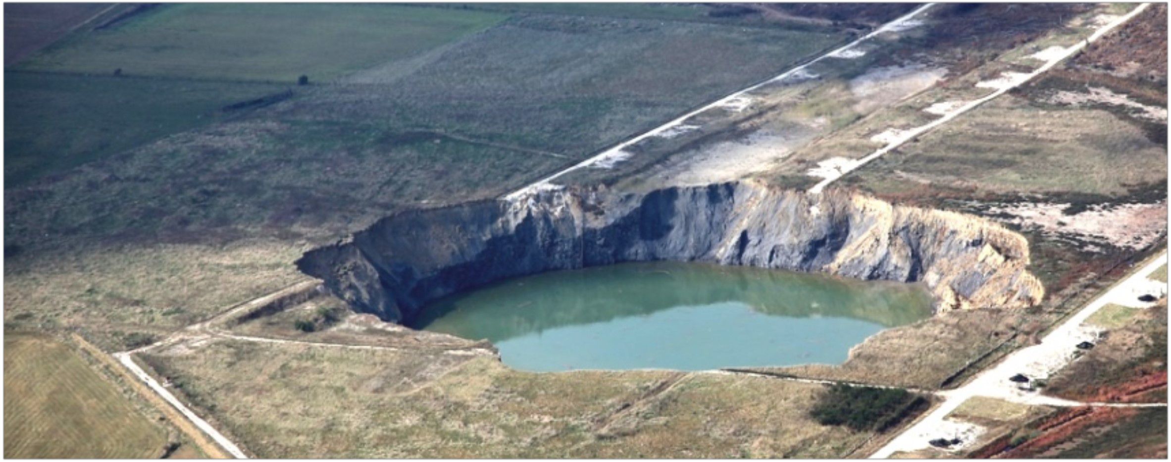
3D elevation view of the cavity from sonar survey. Upper flat limit marks the top of the salt laye
Context
Fast large caving phenomena, followed by underground or surface collapses, are wellknown geohazards encountered in numerous mining situations. In the Lorraine region, France, SOLVAY operates solution mining at 200 meters depth through fresh water injection using a channel and drilling development. This mining method leads to the formation of large surface sinkholes resulting from the controlled collapse of the underground cavities formed by the critical voids created. This strategy aims to avoid any poisoning permanent risk in the future in terms of land management. Nevertheless, the first major failure of the heading cavity is not without risks related to safety at work. Considering all unknowns related to this issue, detecting reliably its onset, full occurrence, quiescence and then new equilibrium offers a obvious benefit to the mine management.Solution
In cooperation with the mine staff, INERIS setup an integrated geodetic, geotechnical and passive microseismic monitoring to better control the growth and eventually the expected collapse. The applied methods were tested regarding their suitability to yield information on induced displacement field, rock strata behaviour and fracturing processes. In situ surface displacement field was sampled by an automatic high resolution infrared tacheometer profile covering the entire lateral cavity extension and a GPS real time kinematic station placed along the vertical axis passing by the top of the cavity determined from a previous sonar survey. Ground displacement measurements and 2D profiles allowed to detect successive different elastic regimes characterising the overall response of the overburden to the growing cavity and also to constrain numerical models.Moreover, a multipoint extensometer deeply anchored in the upper roof provided information on the behaviour of the bedding planes. Data collected explained clearly the dominant role of a 10 meters thick stiff, resistant dolomite blocking the progressive failure of the overlying strata with full microseismic quiescence during several months.
Eventually failure of the limestone strata led to the caving dynamics of the 100 meters superincumbent burden monitored through passive microseismic that recorded several tens of thousands events. After 36 hours of strong underground activity with no visible sign on surface, the decreasing seismic rate and increasing subsidence rate anticipated the appearance of the 150 meters crater shape opening in a few hours.
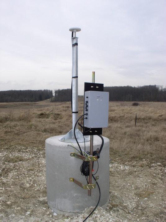
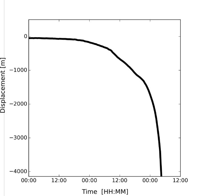
Autonomous SYTGEO RTK-GPS station with high sampling frequency and radio transmission offered a very high quality time series of the 4 meters vertical subsidence recorded during the last two days with an accuracy close to 1cm.
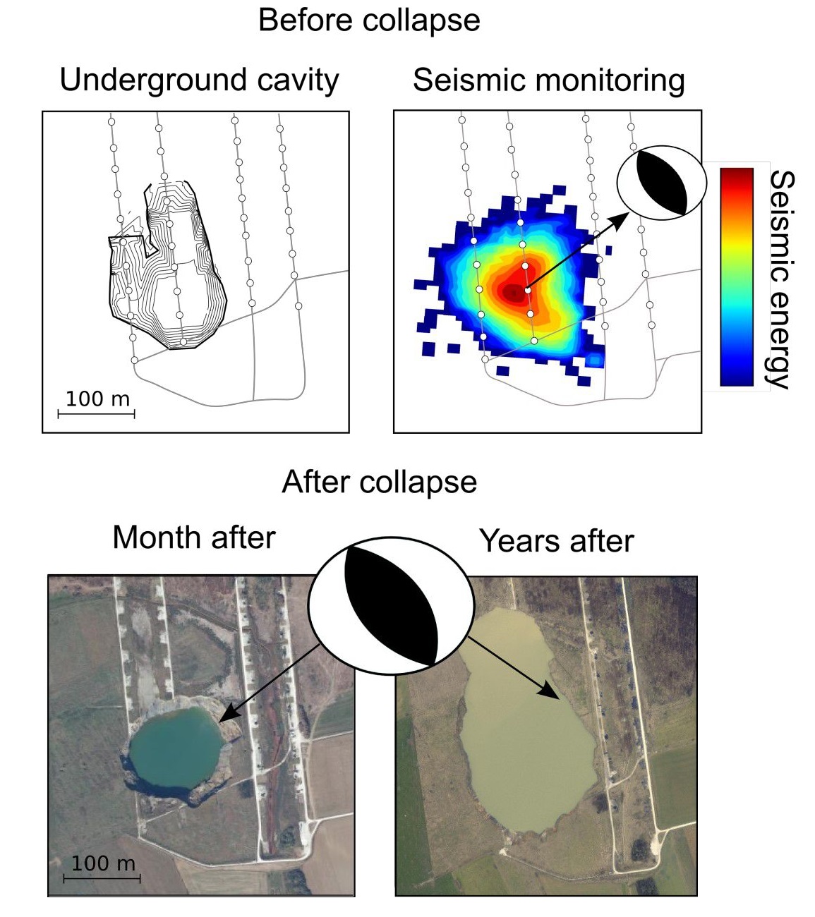
Microseismic postprocessing source analysis indicated the presence of dominant thrust faulting along preexisting structures striking NNESSW which could be later confirmed from aerial photos showing the evolved state of the surface crater several months and years after collapse. The role of the limestone strata and these geological features revealed of fundamental importance to explain respectively the challenge to predict the triggering time and the runaway kinetics of the complete collapse.
Lessons learned
Knowledge and experience gained from this project helped to validate the potential of multiparameter monitoring method, to develop an innovative online microseismic event location method adapted to dense seismic swarms and to improve the calibration of hybrid numerical models.Such technology is nowadays a key component of the safety procedure in a solution mine in Italy, where sinkholes have been successfully anticipated many times, improving the safety at work while optimizing salt production.
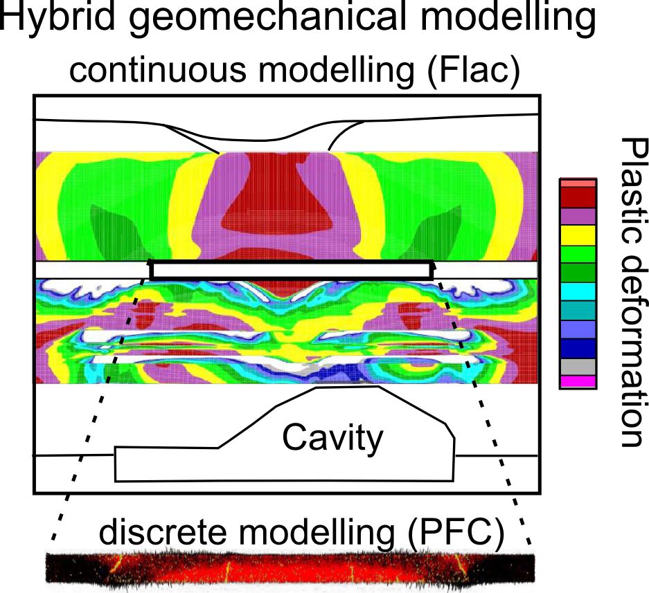
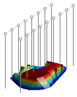
Hybrid geomechanic modeling, constrained by geotechnical data, shows concentration of caving below the stiff dolomite layer (FLAC) and location of discrete fractures involved in its failure (PFC).